
Robert Gavora Fine and Rare Books is on vacation. We are not processing orders until we return.
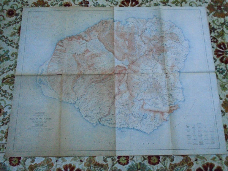
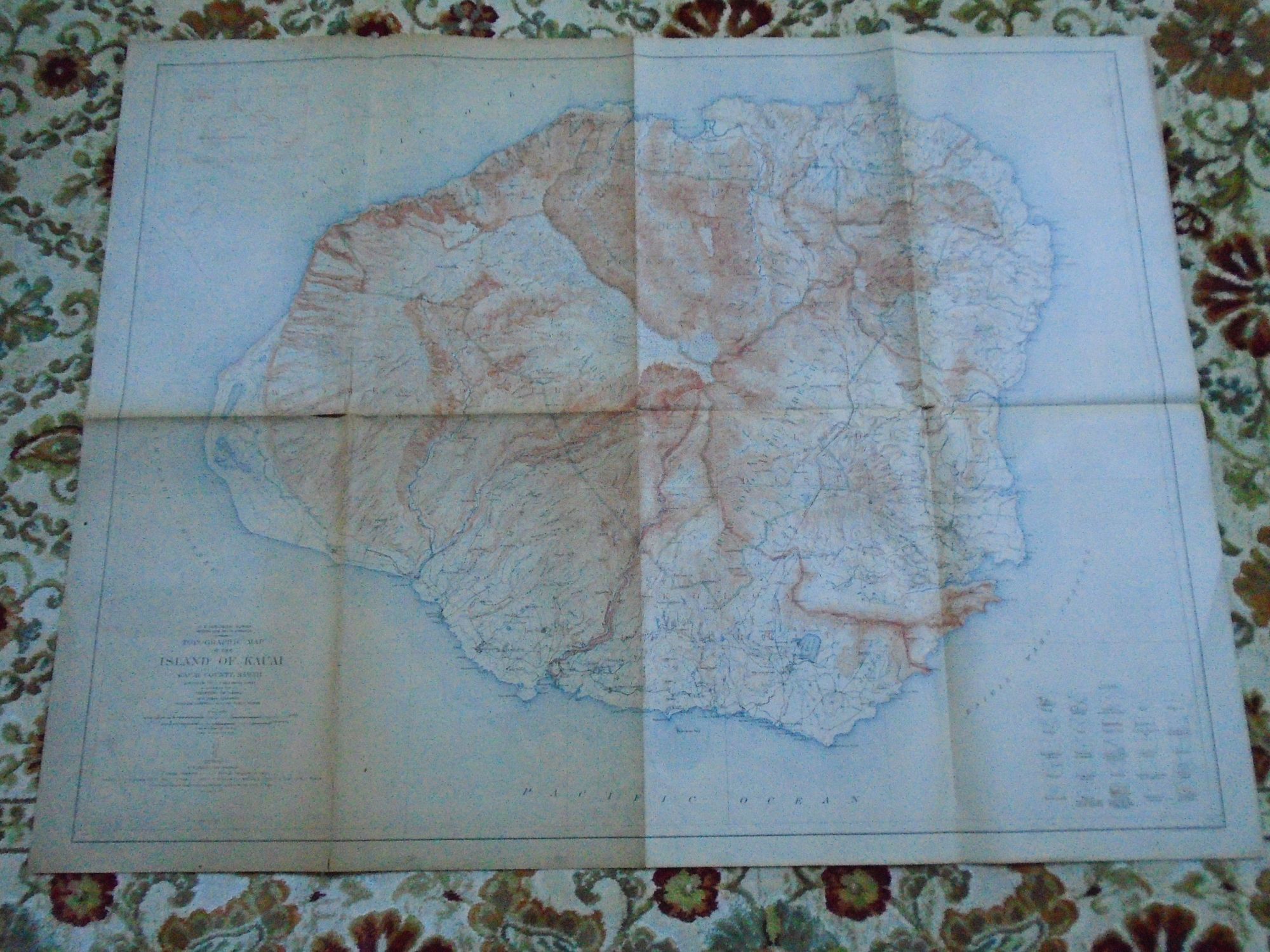
TOPOGRAPHIC MAP OF THE ISLAND OF KAUAI, KAUAI COUNTY, HAWAII. TERRITORY OF HAWAII, 1933
Washington, DC: United States Geological Survey / USGS / Government Printing Office / GPO, 1912. Map. Good. Item #52074
Folded color map sheet measuring 32h X 41w inches. Surveyed 1910. Contour interval 50 ft. This is the 1912 edition. Scale 1/62500. A delicate map with several splits along the folds. Light dusting. A good copy.
Price: $45.00