
Robert Gavora Fine and Rare Books is on vacation. We are not processing orders until we return.
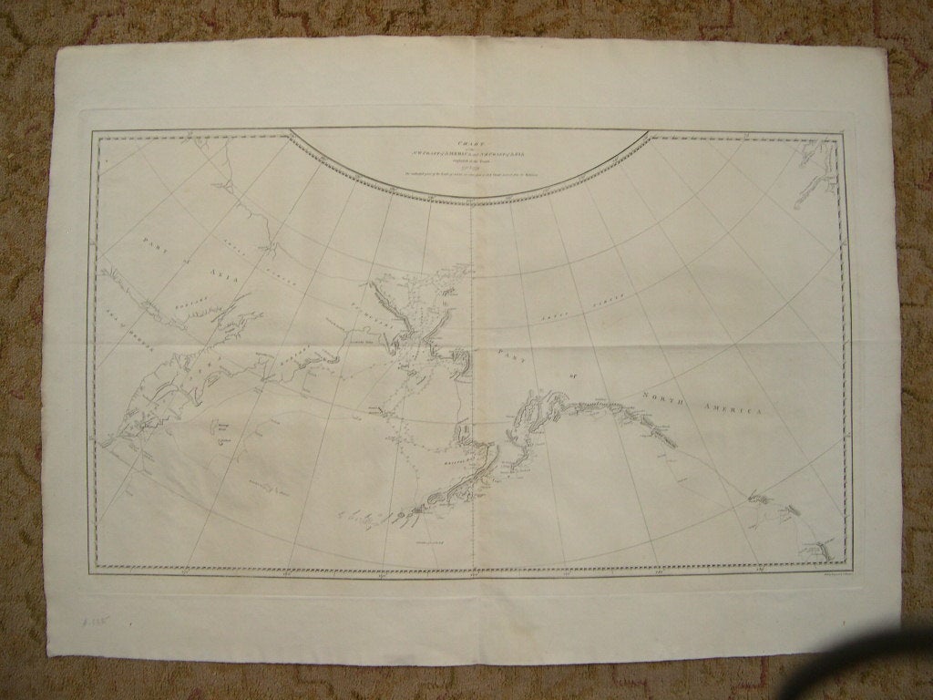
![Item #38202 CHART OF THE NW COAST OF AMERICA AND NE COAST OF ASIA EXPLORED IN THE YEARS 1778 & 1779. THE UNSHADED PARTS OF THE COAST OF ASIA ARE TAKEN FROM A MS CHART RECEIVED FROM THE RUSSIANS [A VOYAGE TO THE PACIFIC OCEAN]. Capt. James. James King Cook.](https://robertgavora.cdn.bibliopolis.com/pictures/38202.jpg?width=768&height=1000&fit=bounds&auto=webp&v=1545156273)
CHART OF THE NW COAST OF AMERICA AND NE COAST OF ASIA EXPLORED IN THE YEARS 1778 & 1779. THE UNSHADED PARTS OF THE COAST OF ASIA ARE TAKEN FROM A MS CHART RECEIVED FROM THE RUSSIANS [A VOYAGE TO THE PACIFIC OCEAN]
London: G. Nicoll and T. Cadell, 1784. Map. Item #38202
Plate 36 from the atlas volume of Cook, James; A Voyage to the Pacific Ocean: Undertaken, by the Command of His Majesty, for Making Discoveries in the Northern Hemisphere, published by G. Nicoll and T. Cadell; London, 1784. Writing engraved by T. Harmer. Wagner; Cartography of the Northwest Coast of America, 696. Map printed border to border measures 15.25 x 26.5 inches, plate impression 16.75 x 27.25 inches, sheet 21.5 x 30 inches. An exceptionally nice uncolored copy. Request a higher resolution photograph if required.
Price: $1,200.00
See all items in
Western Americana
See all items by Capt. James. James King Cook